
Exhibo Editorial
Mapping the Hidden Geoglyphs of Ancient Amazonia
Lidar technology uncovers vast networks of ceremonial earthworks, rewriting narratives of pre-Columbian forest societies
Beneath the Canopy
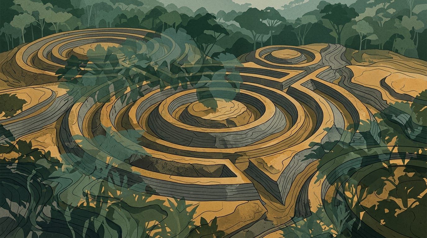
Recent investigations published in Nature have fundamentally altered our understanding of South American archaeological history. By deploying airborne laser scanning across more than four thousand kilometres of flight paths over Acre and Amazonas, researchers have mapped upwards of twenty thousand previously undocumented earth formations. These geometric enclosures, characterised by substantial embankments and excavated trenches, belong to a society historically referred to as the Aquiry. Flourishing between the sixth century before Christ and the ninth century AD, this cultural network spanned roughly one hundred and eighty-three thousand square kilometres across present-day Brazil, Bolivia, and Peru.
For decades, academic consensus maintained that the western Amazon functioned as an untouched ecological reserve, incapable of sustaining dense populations or sophisticated territorial planning. The new data dismantles that narrative entirely. Archaeologists now estimate that the region supported between 1.25 million and three million inhabitants during its demographic zenith around the second century AD. Rather than isolated villages scattered across unmanaged woodland, the evidence points to a highly organised landscape engineered through deliberate agricultural and ceremonial practices.
Engineering Memory and Landscape
The discovered monuments were never intended as defensive fortifications or conventional urban centres. Instead, they operated as ritual hubs and political assemblies linked by extensive thoroughfares. Inhabitants cultivated staple crops like maize and squash while actively cultivating native arboreal species, including Brazil nuts and various palms. This approach has led scholars to describe a distinct model of forest urbanism: a polycentric system where human settlement, hydrological networks, and modified ecosystems coexisted without rigid boundaries. The sheer scale of soil displacement required to construct these features demonstrates a profound capacity for coordinated labour and long-term environmental stewardship.
The breakthrough emerged from a collaboration initiated in the early twenty-first century. Finnish researcher Martti Pärssinen first encountered the terraced landscapes alongside Alceu Ranzi, a Brazilian academic observing the formations from above. Initial documentation relied heavily on cleared zones and orbital photography, leaving the majority of the terrain obscured. Contemporary light detection and ranging systems finally penetrated the dense foliage, revealing that the known footprint of these geoglyph-building communities was approximately triple previous calculations.
From an artistic and architectural standpoint, these earthworks represent a radical departure from Western monumentality. Rather than relying on vertical stone construction, the builders manipulated horizontal planes, creating vast canvases of compacted soil and carved channels. The alignment of ditches and mounds suggests a sophisticated grasp of geometry and celestial observation, functioning simultaneously as practical infrastructure and symbolic cartography. This deliberate reshaping of natural contours challenges modern dichotomies between nature and culture, presenting instead a continuous dialogue where human intervention enhances rather than diminishes ecological complexity. The preservation of these sites under thick vegetation further underscores how deeply intertwined human history and botanical growth truly are.
Rethinking the Amazonian Narrative
Independent experts emphasise that these discoveries do not suggest a vanished empire waiting to be rescued from obscurity. Venezuelan archaeologist José Miguel Pérez-Gómez notes that Western historiography simply lacked the conceptual framework to recognise alternative civilisations. The monuments functioned as living archives, transforming topography into calendrical markers, ritual stages, and mechanisms for social cohesion. Such spatial arrangements prioritise connectivity over concentration, offering valuable parallels for contemporary discussions regarding sustainable development and indigenous knowledge systems.
Given that the surveyed sector accounts for less than three percent of the entire Amazon basin, the implications extend far beyond regional archaeology. If similar patterns persist across the wider watershed, the historical record requires comprehensive revision. The integration of advanced remote sensing with traditional fieldwork continues to peel back layers of ecological and cultural history, proving that the forest itself remains an active participant in shaping human legacy. As researchers continue mapping these subterranean geometries, the conversation inevitably shifts toward what other monumental interventions remain concealed beneath the canopy.
Related reading

Gustave Fayet: Collector—Artist Designer
A comprehensive survey at the Fondation Louis Vuitton reuniting collected masterpieces with the designer's own studio practice.
The Paris institution expands its patronage series with a dual-focused examination of Gustave Fayet, bringing together hundreds of acquired works and restored creations to chart his impact on early modernism.

Mohammad Alfaraj: The Heart Is a Bird's Nest, the Brain Is a Spider Web
First European institutional solo explores cross-species kinship and domestic ecologies
Mohammad Alfaraj's latest showcase at the Delfina Foundation merges multimedia installations with regional folklore to reimagine shared habitats.

Vancouver Establishes Cultural Land Trust Amid Artist Housing Crisis
A new municipal framework seeks to secure long-term studio space and prevent creative displacement.
Vancouver's council has approved a structural mechanism to retain artists and nonprofits as soaring property costs threaten the city's creative sector.